I can’t help but get a reassured feeling as our mini van drives along the coast, past the multi-coloured fishing vessels pulled up on the beach with their white and blue nylon fishing nets drying in the sun. As we cruise past the Cricket grounds the familiar limestone and coral ramparts of Galle fort rise up out of the green grass like a welcoming friend and it’s good to back. Galle fort is no doubt one of Asia’s most perfectly preserved colonial towns and worth taking the time to visit if you are in Sri Lanka.
Most people think that the fort only dates back to the period of Dutch rule, who captured Galle from the Portuguese in 1640 and spent the next 156 years fortifying and embellishing the town, simply because their work remains apparent everywhere, with narrow streets of low-slung colonial villas protected by massive bastions with the gentle crash of breaking waves just beyond. Some people however believe that this is the legendary Tarshish, the port city where, according to the Bible, ships trading with King Solomon obtained elephants, peacocks and gemstones. The ancient Greeks, the Egyptians, the Arabs and even the Chinese in 1406 all recognised the city as a significant trading place. Galle is also the harbour where in 1505 the Portuguese made their first landing on the island, recognising its potential they seized it from the Sinhalese kings eighty years later, building a small fort out of palm trees and mud, which they called Santa Cruz de Gale. It is the site of one of the bloodiest battles fought between the Dutch and Portugese, where although the siege of the fort by the Dutch in 1640 only lasted four days, up to a thousand Dutch troops and over 400 Portuguese were killed. Anyway enough history before I put you all to sleep or bore you to death.
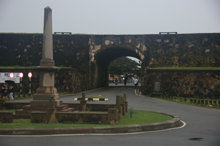
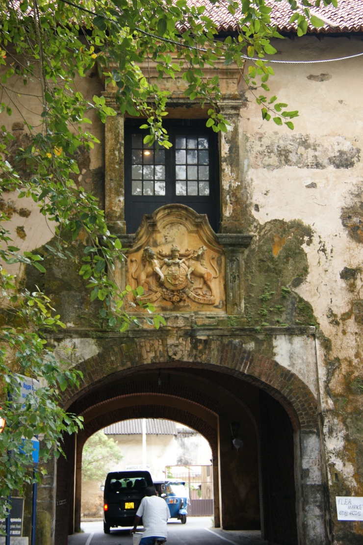
The entrance to Galle Fort is through the Main Gate, which overlooks the Galle cricket stadium and the busy bus station. The gate was created by the British in 1873 by tunnelling through the embankment that links the western Star Bastion with the eastern Sun Bastion, easily identifiable by the clock tower that looms over the central Moon Bastion. The Dutch built the original ramparts to withstand enemy cannonballs however more than 300 years later the fort’s walls were still up to the task keeping the fort area safe from the devastating force of the 2004 Indian Ocean Tsunami.
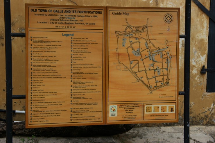
Traversing the narrow cobblestone streets you can easily imagine that you are in a medieval town in Europe. Being a UNESCO World Heritage site most of the buildings in this walled city date back to when it was a Dutch colonial fort. It’s like being in a time warp.


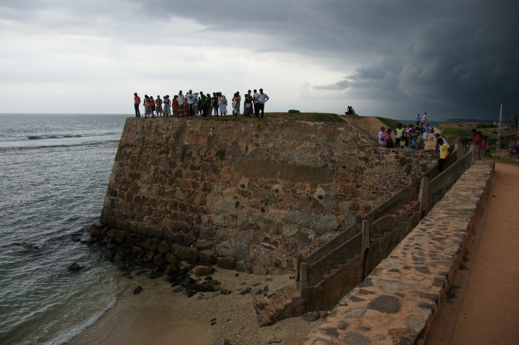
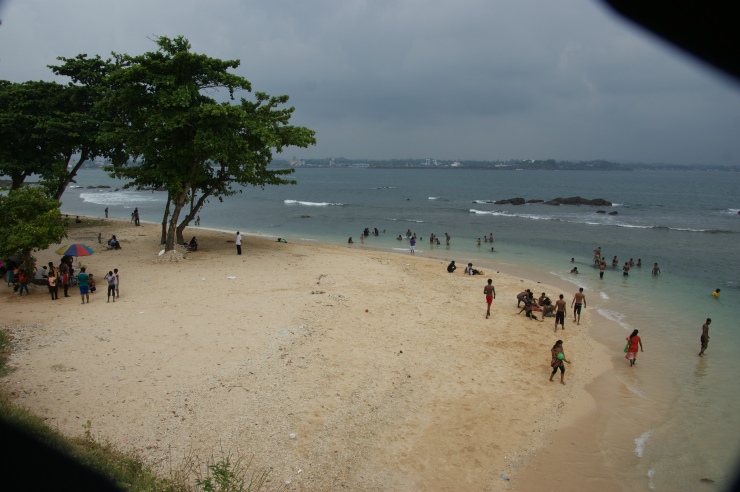
The street leading from the Main Gate is Lighthouse Street, so called because the original 1848 lighthouse was located at the end of the street. However when it burnt down in 1934 it was rebuilt round the corner, at the end of Hospital Street. Once through the tunnel at the main gate you arrive at a small roundabout, at the centre is a small cenotaph recognising those soldiers who died in the First World War. At the southern most end of the street is the Flag Rock Bastion, so named because approaching ships were signalled from the bastion warning them of dangerous rocks, following which musket shots were fired from Pigeon Island, close to the rock. Then if the captain missed all those warnings it was simply too late. Nowadays it is the most popular place for locals and tourist to watch the sun slowly set into the sea. During daylight hours you are often approached by enterprising local daredevils wanting to get paid to leap into the surrounding sea from the rock outcrop.
Running parallel with the sea wall of Galle Fort is Rampart Street. This is where you want to be in the early evening as it turns to dusk, in fact it’s where everyone goes for a stroll at sunset. The view of the sun slowly sinking into the blue azure of the Indian Ocean is awe inspiring. It’s particularly busy at the western end near Flag Rock Bastion, with vendors selling homemade lace nighties and tablecloths or the occasional snake charmer, who is quick to sport you taking a photo and equally quick at demanding payment. So head back the other way to the Triton Bastion, commonly known as Battery Point, here you are about midway along the western rampart. According to the records there used to be a windmill here which drew water to wash down the roads in the fort. An ideal spot to take in the ocean views is across the street at the two storey white stone washed Rampart Hotel, here you should take a seat on the open balcony in the upper dining room and down an ice cold Lion beer, out of the burning sun.
If you’re more adventurous keep on walking along the rampart until you get to the Neptune Bastion, at this point Rampart Street curves back into the fort. A little bit further on is the Clippenberg Bastion, so named because klippen means jutting into the sea and burg means village – a perfect description of this Dutch gun platform (though there is no village – it does jut out over the sea).


The next landmark along the wall is the Black Fort. This was the first fortification, or Fortaleza, that the Portuguese built at Galle in 1625. Located on a cliff jutting out to sea, they named it Santa Cruz (Holy Cross). The Dutch when they took over renamed it Zwartc (Black Fort) because during the bloody siege of the fort in 1640 this area was constantly covered by the dark smoke emanating from the fire of canons, guns and blacksmiths. Unfortunately the Black Fort is now the Office of the Police Superintendent and closed to the public. The next stop along the wall is the Akersloot Bastion, so called because the Dutch Commander who conquered the fort came from Akersloot in Holland. It is located behind the newly restored Dutch Hospital building, which houses a collection of shops and restaurants. I can highly recommend ‘A Minute by Tuk Tuk’ or ‘Cannon Bar & Grill’. The white washed two storey building with its long colonnaded verandas was built by the Dutch in the 17th Century, constructed on the site of the Portuguese mint, and was subsequently used as a barracks by the British and the local town hall by the Sri Lankans (following the country’s independence) . If you look in the courtyard you’ll find an old breadfruit tree, which is believed to the first bread fruit tree ever planted in Sri Lanka.
Trekking westwards along the old fort wall you’ll reach the Auruoa Bastion, originally constructed by the Dutch (the Portuguese didn’t construct any fortifications facing the harbour) and called the Nieuwe Punt (New Point), then the Halve Bolwerk (Half Bastion) before its current moniker, named after the Roman goddess of dawn, Aurora, as you get the best views of sunrise at this location.


What to see
Dutch Church
All Saints Church
Maritime Archaeology Museum
Seenigama temple
Where to shop
Barefoot – 41 Pedlar St
Luv SL by Odel (C. P. Hayley Building – Pedlar St)
Three by TPV – 43 Leyn Baan St
Stick No Bills – 35 Church St
KK The Collection – 36 Church St
Mimimango – 56A Lighthouse St
Exotic Roots – 32 Church St
Shoba – 67A Pedlar St
Exotic Roots – 36 Church St
Spa Ceylon – 63 Church St

4 thoughts on “Self-Guided walking tour of Galle Fort (Tarshish & the VOC)”